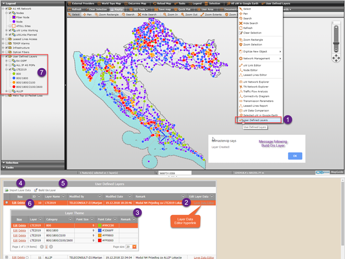
•End users can create custom GIS layers dynamically using context menu command User Defined Layers (1).
oAll user defined layers are saved into the database.
▪Layer Editor (2), defines basic attributes as layer name, layer author and update date.
▪Layer Editor child grid is Layer Theme Editor (3) which specifies point size and point color of Data Category .
oLayer name and the layer theme must be defined prior to any layer data import into the database.
oLayer Data in the form of Excel xlsx file is uploaded to the web server with the possibility to further edit data with the integrated web spreadsheet editor.
▪Data can be saved back in the original format.
▪Finally data is exported into the database table.
▪Layer data saved into the database can be edited with User Layer Data Editor.
oBuild Gis Layer button (5) creates selected layer according to the thematic defined in the Layer Theme (3).
▪User Defined Layers group in the Map Legend (7) is updated with newly created layer.
oDeleting the Layer automatically cleans all related data in User Defined Layers group;
▪Layer theme,
▪Layer data and
▪Layer visualization.

Figure 12: End users can create GIS layers dynamically according to custom rules.