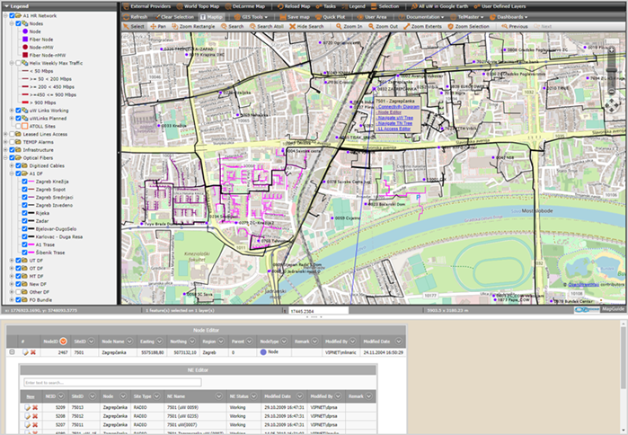
•TelMaster Network GIS main task is to manage network assets and operational parameters in a consistent manner using custom developed tools.
oTelMasterGIS is 64 bit Web application running on Internet Information Services (IIS) web server based on MapGuide Open Source and following supporting technologies:
▪Microsoft SQL Server database consisting of data tables, views, stored procedures, functions and SSIS ETL procedures.
▪ASP.NET based custom developed user interface elements, algorithms and GIS manipulation routines.
•Presently three TelMasterGIS Maps are implemented;
•Maps coordinate system is
o WGS84.PseudoMercator (WGS84 based Mercator (spherical formulation)).
•Each Map can have map overlays from public map providers;
oOpen Street Map,
oWorld Topo Map,
oDeLorme Map,
oStamen Terrain, Toner or WaterColor.

Figure 10: TelMasterGIS covers all transmission aspects of triple play provider.